|
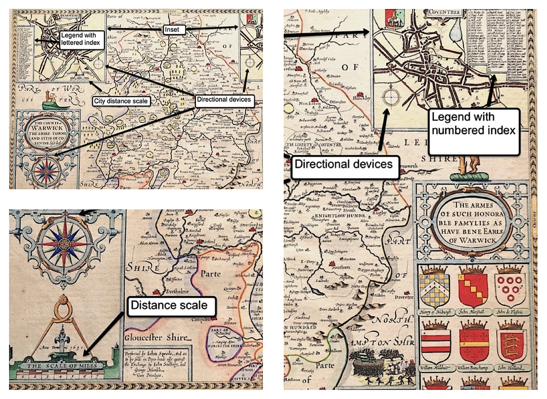
There's a handful of elements besides the Cartouche that make up a maps Ornamentation . With most 16th to 18th century maps you will want to be aware of these and they are shown in the boxes below. Maps were made to different scales so it would be logical for there to be a ratio that compared the measurement on the map to the actual distance. These scales are normally shown by means of multiple scale bars for the units of measurement to the mile. Another feature is whats known as the 'Legend'. This simple device contains the explanation for symbols used on the map such as towns, roads, canals, rivers, forts, bridges etc. Many old maps have different symbols for the likes of market towns, cathedral towns and fortifications, within somelegends there is a simple numbered or alphabetical index. Getting a basic understanding of a maps anatomy so you're able to identify the ornamental parts that make up a map is essential . . . Know your ORNAMENTATION
|
LEARN ABOUT MAPS Where to Start? The Paper Earliest Maps Whats on the Paper? Rectum & Recto Marketing Devices Why Changing Faces? What is Ornamentation? Why all those lines? The Embellishment Story Illogical Prices Explained A Reference Library CLICK THE BOOK
Get the FREE Guide!
COLLECTING MAPS
Size Matters! Celestial Maps Strip Road Maps Sea Charts On the River of Life Projections The Sea Monsters Thematic Maps Town Plans Buy with Confidence. . .
More Top Tips for the Novice. Click the book to find out more . . .
COLLECTING PRINTS
Views of River Thames
Views of London Shipping & Craft Meet the Fairies Maritime Naval Military Battles Botanical Historic Churches Historic Views of Rome Archives
May 2024
|


