- Published on
As promised another of the exceptional aquatint prints from James Jenkins The Naval Achievements of Great Britain, From the Year 1793 to 1817. These prints are exceptional in themselves with excellent hand colour. To give you more of an insight into the event as recorded I've shared a brief excerpt from the original written account published within Naval Achievements here below the print.
Engageante was captured, along with Pomone and Babet, off the Île de Batz during the Action of 23 April 1794. Her captor was HMS Concorde.... In the evening after the action Engageante's masts fell overboard, and Concorde's masts were kept upright only with great difficulty.
The naval campaigns, operations and battles of the Napoleonic Wars were events during the period between 1802 and 1814 that were undertaken by European powers in support of their land-based strategies.
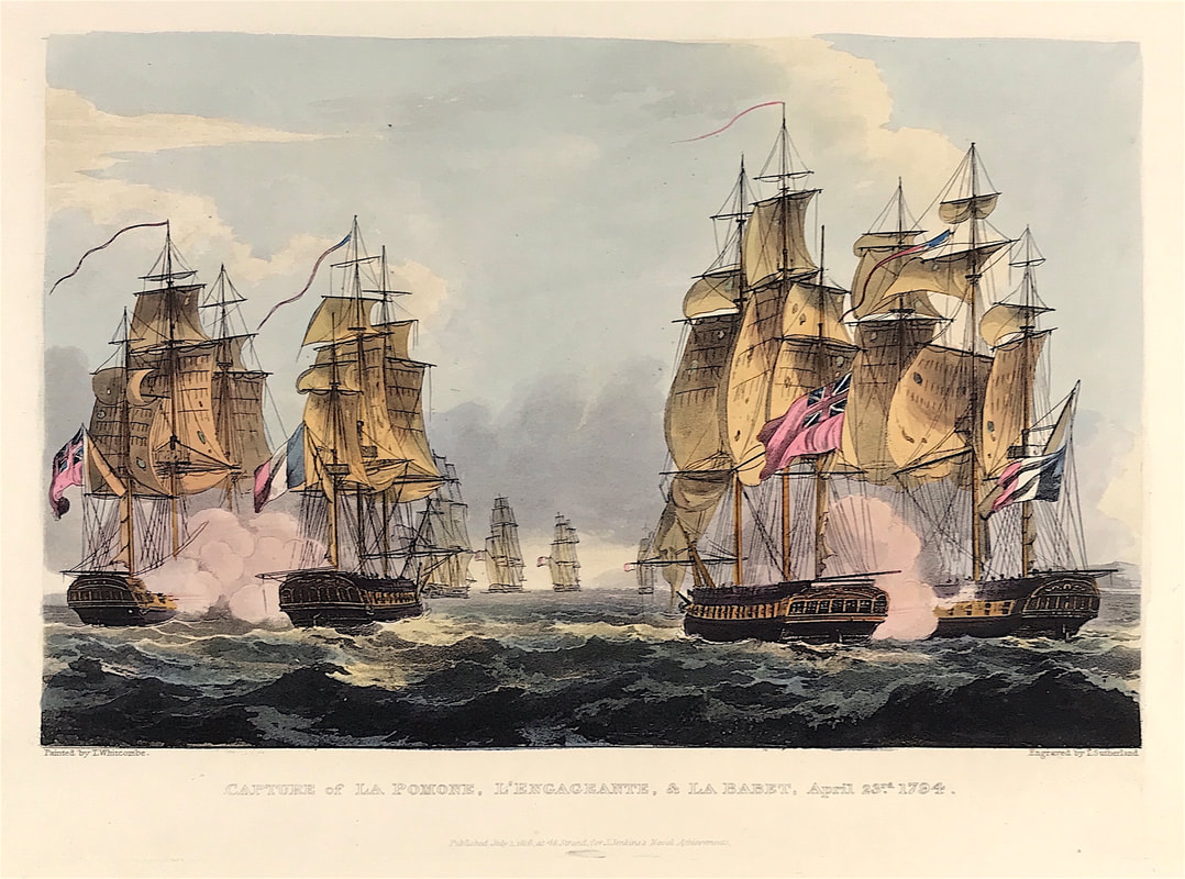
Above: The Capture of La Pomone L' Engageante and La Babet April 23rd 1794 from The Martial achievements of Great Britain and Her Allies from 1799 to 1815 by J. Jenkins.
Excerpt from the written account as published:
CAPTURE OF LA POMONE, L'ENGAGEANTE, AND LA BABET, APRIL 23, 1794.
Sir John BORLASE WARREN having been dispatched by Admiral Macbride on a cruise off the coast of France, steered for the Seven Islands on the coast of Brittany; and on the 230 April discovered a French squadron, consisting of four sail, standing out of Concale Bay. Orders were immediately given to pre pare for action, and the British squadron bore down to attack.
The annexed plate represents the Flora and Arethusa engaging La Pomone and La Babet to leeward, at the time La Babet struck her colours. The Melam pus, the Nymph, and the Concord are in the distance, pursuing the flying enemy.
The following is a copy of the letter sent by Commodore Warren to Admiral Macbride, detailing the particulars of the above action.
FLORA, at Sea, April 25, 1794.
Sir: In pursuance of your orders, I proceeded with the ships named in the margin, to cruise off the coast of France; and on the 23d instant, from variable winds, being to the westward of Guernsey, Rock Dove bearing E. by S. four or five leagues, the Seven Islands S. S. W. four or five leagues, Guernsey N. E. { E. seven or eight leagues, I discovered, at four in the morning, four sail standing out to sea upon the larboard tack, the wind S. S. W.; and as the morning began to break, I saw, from their manæuvres and firing of guns, that they were some of the enemy's ships of war: they soon afterwards appeared in a line of battle on the larboard tack, and as our ships, from having chased, were not collected, I made the signal to form in succession. We crossed each other on contrary tacks, and the enemy began an action at a considerable distance: the sternmost ship having passed over, they again tacked; but the wind changing two points in our favour . . .
How to Identify the Prints:
The original prints from "The Naval Achievements of Great Britain. From the Year 1793 to 1817" are aquatint engravings on a medium weight wove paper. All the plates identify at bottom left Painted by T. Whitcombe and bottom right T. Sutherland (sculpt) who produced the aquatint engravings. Some plates were engraved by Jeakes and Bailey after Whitcombe. Each plate is accompanied by text pages describing the action, often with lists of ships captured or sunk, and excerpts from contemporary bulletins, dispatches, letters, and speeches. The first edition appeared in 1817. Early issues have watermarks of J. Whatman with the undated watermark IIS&S on some plates. The vignette title page was uncoloured in the first issue. The approx engraved image area of the plates are 7" x 10.25" (175mm x 260mm). Engraved plate mark area is approx 8.5 x 11.75 (215mm x 300mm). The folio sheet size is approx 11.5" x 14" (290mm x 355mm).
You can see more prints from Jenkins The Naval Achievements of Great Britain, From the Year 1793 to 1817 HERE. If you're interested in a specific print and you cannot see it on my website please feel free to message me.
0 Comments

