- Published on
As promised another of the exceptional aquatint prints from Jenkins The Martial achievements of Great Britain and Her Allies from 1799 to 1815. Below the print is a short excerpt from the original written account as published with the print.
In the Battle of Roliça an Anglo-Portuguese army under Sir Arthur Wellesley defeated an outnumbered Imperial French division under General of Division Henri François Delaborde, near the village of Roliça in Portugal. The French retired in good order. Formerly spelled Roleia in English, it was the first battle fought by the British army during the Peninsular War.
In the Battle of Roliça an Anglo-Portuguese army under Sir Arthur Wellesley defeated an outnumbered Imperial French division under General of Division Henri François Delaborde, near the village of Roliça in Portugal. The French retired in good order. Formerly spelled Roleia in English, it was the first battle fought by the British army during the Peninsular War.
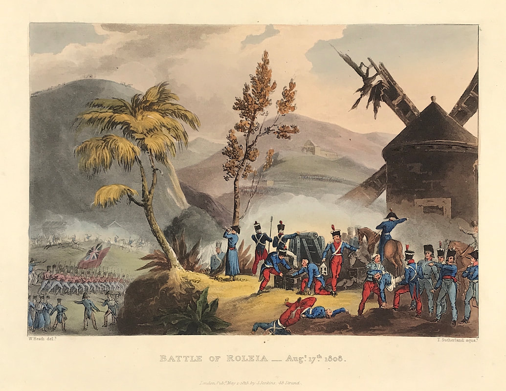
Above: Battle of Roleia Aug 17th 1808 from Jenkins The Martial achievements of Great Britain and Her Allies from 1799 to 1815.
Excerpt from the written account as published:
THE BATTLE OF ROLEIA. The fore-ground in the annexed plate is occupied by a part of the enemy's force, consisting of the staff of the French General Laborde, who are reconnecting; while many of the troops are employed in carrying their wounded country men to the windmill which occupies so prominent a place in this part of the scene, and which the enemy made a depository for his sick and wounded.
Extract from the Dispatch of Lieutenant-General Sir Arthur Wellesley, dated August 17, 1808.
The columns being formed, the troops moved from Obidos about seven o'clock in the morning. Brigadier-General Fane's riflemen were immediately detached on to the hills on the left of the valley, to keep up the communication between the centre and left columns, and to protect the march of the former along the valley, the enemy's posts being successively driven in. Major-General Hill's brigade, formed in three columns of battalions, moved on the right of the valley, supported by the cavalry, in order to attack the enemy's left; and Brigadier-Generals Nightingale and Crauford moved with the artillery along the high road, until at length the former formed in the plain immediately in the enemy's front, supported by the light infantry companies and the 45th regiment of Brigadier-General Crauford's brigade; while the two other regiments of this brigade (50th and 91st) and half of the nine-pounder brigade, were kept as a reserve in the rear. Major-General Hill and Brigadier-General Nightingale advanced upon the enemy's position; and at the same moment Brigadier-General Fane's riflemen were in the lills on his right, the Portuguese infantry in a village upon his left, and Major-General Ferguson's column was descending from the heights into the plain. . . .
How to Identify the Prints:
The original prints from The Martial achievements of Great Britain and Her Allies from 1799 to 1815 are aquatint engravings on a medium weight wove paper. Plates also exist that were printed on India Paper. They should clearly identify bottom left W. Heath (delt) who did the drawings and bottom right T. Sutherland (sculpt) who produced most of the aquatint engravings with some by D. Havell, M. Dubourg and J. Hill. Each plate has the date of publication and the name of the publisher beneath the engraved title. The approx engraved area of the plates are 8.5" x 7.75" (215mm x 195mm) including the engraved title text. Engraved plate mark area is approx 8.5 x 11.75 (215mm x 300mm). The large sheet size is approx 11.5" x 14" (290mm x 355mm).
You can see more prints from Jenkins The Martial achievements of Great Britain and Her Allies from 1799 to 1815 HERE. If you're interested in a specific print and you cannot see it on my website please feel free to message me.
0 Comments

