- Published on
As promised another of the exceptional aquatint prints from James Jenkins The Naval Achievements of Great Britain, From the Year 1793 to 1817. These prints are exceptional in themselves with excellent hand colour. To give you even more of an insight into the event recorded I've shared a brief excerpt from the original written account published below the print. The naval campaigns, operations and battles of the Napoleonic Wars were events during the period between 1802 and 1814 that were undertaken by European powers in support of their land-based strategies.
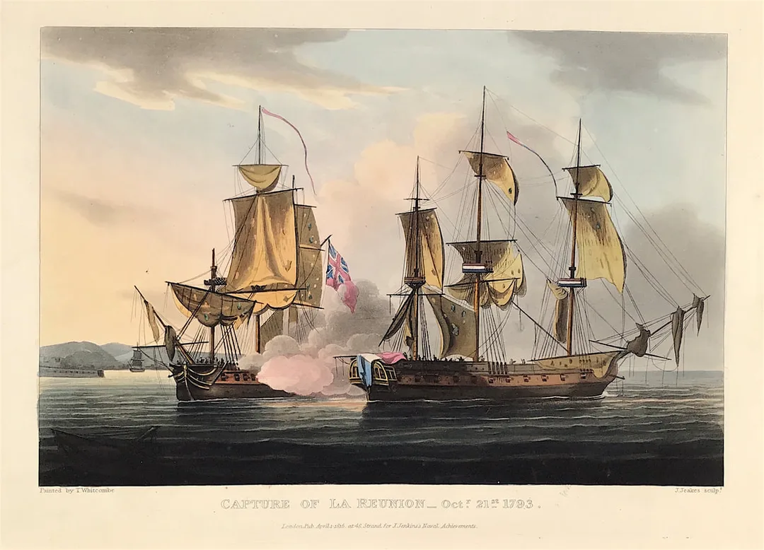
Above: The Capture of La Reunion Oct 21st 1793 from The Martial achievements of Great Britain and Her Allies from 1799 to 1815 by J. Jenkins.
Excerpt from the written account as published:
At the commencement of hostilities in 1793, Captain Saumarez hoisted his pendant on board the Crescent frigate, of 36 guns and 260 men. After having been employed on various services, he sailed from Spithead, on a cruise, on the 20th October, 1793. Having received information that there were two frigates stationed at Cherbourg, he proceeded off that port, and on the following morning, being close to Cape Barfleur lighthouse, discovered a frigate, in company with a large cutter; the Crescent was on the larboard tack, with the wind offshore, and immediately edged down to the enemy, and in a short time brought her to close action. Both ships were soon much disabled: the Crescent had her fore top sail-yard and her fore top-mast shot away, but coming suddenly round on the opposite tack, with the helm hard a-starboard, she was enabled to bring her lar board guns to bear; when Captain S. immediately seized the opportunity of raking his opponent, which soon became totally unmanageable, and was forced to strike her colours, in sight of multitudes by whom the adjacent coast was covered. Another of the enemy's frigates attempted to come out of Cherbourg, for the purpose of supporting her, but La Réunion was captured before she could receive any succour. The cutter made all sail into port, not daring to come into action.
How to Identify the Prints:
The original prints from "The Naval Achievements of Great Britain. From the Year 1793 to 1817" are aquatint engravings on a medium weight wove paper. All the plates identify at bottom left Painted by T. Whitcombe and bottom right T. Sutherland (sculpt) who produced the aquatint engravings. Some plates were engraved by Jeakes and Bailey after Whitcombe. Each plate is accompanied by text pages describing the action, often with lists of ships captured or sunk, and excerpts from contemporary bulletins, dispatches, letters, and speeches. The first edition appeared in 1817. Early issues have watermarks of Whatman with the undated watermark IIS&S on some plates. The vignette title page was uncoloured in the first issue. The approx engraved image area of the plates are 7" x 10.25" (175mm x 260mm). Engraved plate mark area is approx 8.5 x 11.75 (215mm x 300mm). The folio sheet size is approx 11.5" x 14" (290mm x 355mm).
You can see more prints from Jenkins The Naval Achievements of Great Britain, From the Year 1793 to 1817 HERE. If you're interested in a specific print and you cannot see it on my website please feel free to message me.
0 Comments

