RARE MAPS AND PRINTS
[email protected]
+44 7788 628706
  • About
  • Maps
    • British Isles
    • English Counties
    • Road Maps
    • River Thames
    • The Americas
    • Asia to Australia
    • Europe & Middle East
    • World & Hemispheres
    • Sea Charts
    • Military Battle Maps
  • Prints
    • British Topography >
      • Views England & Scotland
      • Views Wales
      • Views London
      • Views River Thames
    • Sporting
    • Amorial
    • Military & Naval
    • Portrait
    • Russian Art
    • Views Italy
  • Resources
    • Reference Books
  • Blog
  • The Colourist

An Antique Map of England & Wales for the use of Eton School

9/10/2020

Comments

 
The name Arrowsmith is well known in map circles. Arron Arrowsmith (1750-1823) was the founder of one of the leading London map publishing houses in the early nineteenth century. He worked as a surveyor for John Cary, working on various road surveys which appeared in Cary's Travellers Companion in 1790. Having established his own business his reputation became widespread internationally as he specialised in compiling maps recording the discoveries made in different parts of the world. Arrowsmith was also diligent in revising and improving his maps to keep them current, and served as an inspiration for the next generation of surveyors.
Picture
​When Arron died in 1823 the business and title of Hydrographer to the King passed to his sons, Aaron (1802-1854) and Samuel (1805-1839) who worked as partners from 1823 to 1832, when Aaron resigned to join the church. While the partners never achieved the heights of their father, in addition to reprinting from his stock, they produced numbers of important maps for the Parliamentary Papers, a school atlas, a bible atlas and a series of wall maps of classical history.  Samuel died at age 34 in 1839; his brother presided over his funeral. The remaining stock and copper plates were bought at auction by John Arrowsmith, their cousin.

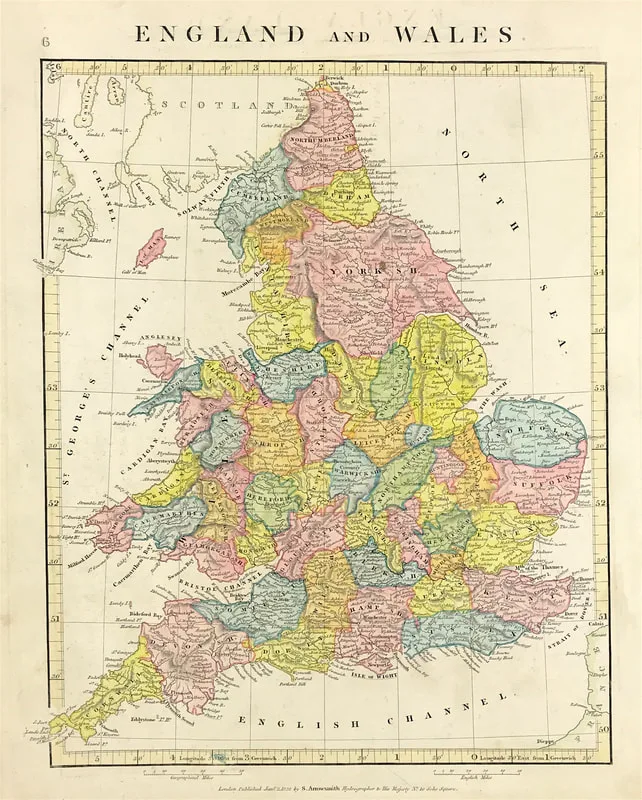
This map is an example from the school atlas: A Comparative Atlas of Ancient And Modern Geography, From original Authorities, and upon a New Plan For The Use Of Eton School, By A. Arrowsmith, Hydrographer to His Majesty. 1828. London, Published by the Author, 10, Soho Square, Sold also by E. Williams, Eton, and at the Eton Warehouse, 10, Red Lion Court, Fleet Street. This edition Published Jany. 2, 1828 by S. Arrowsmith Hydrographer to His Majesty, No. 10, Soho Square.
Comments

    LEARN ABOUT MAPS

    Where to Start?  
    The Paper  
    Earliest Maps  
    Whats on the Paper? 
    Rectum & Recto  
    Marketing Devices   
    Why Changing Faces?
    What is  Ornamentation?
    Why all those lines?
    The Embellishment Story

    Illogical Prices Explained
    ​A Reference Library
    ​
    CLICK THE BOOK
    Picture
    Get the FREE Guide!
    ​
    ​
    COLLECTING MAPS

    ​Size Matters!

    Celestial Maps
    Strip Road Maps
    Sea Charts
    On the River of Life
    Projections
    The Sea Monsters
    Thematic Maps
    ​Town Plans


    Buy with Confidence. . . 
    Picture
    More Top Tips for the Novice.  Click the book to find out more . . .
    COLLECTING PRINTS
    ​

    Views of River Thames
    Views of London
    Shipping & Craft
    ​Meet the Fairies
    Maritime Naval
    Military Battles
    Botanical 
    Historic Churches
    Historic Views of Rome

    Archives

    May 2024
    October 2023
    November 2022
    September 2022
    August 2022
    July 2022
    November 2021
    July 2021
    June 2021
    May 2021
    April 2021
    March 2021
    February 2021
    January 2021
    December 2020
    November 2020
    October 2020
    September 2020
    March 2020
    November 2019
    June 2019
    May 2019
    April 2019
    March 2019

Contact Info:     
Rare Maps and Prints Limited 
4, Ray House, Cressington Place,
​Bourne End, Bucks SL8 5SL UK 
                             
Kevin J Ryan :     

email: [email protected]         
​
    
          
Picture
Member of
​INTERNATIONAL MAP COLLECTORS SOCIETY 


    Maps & Prints Updates

Subscribe to List

Copyright © 2025 -  Rare Maps and Prints Limited  -  Raremapsandprints.co.uk   All Rights Reserved     Site Map     Terms & Conditions     Privacy Policy
  • About
  • Maps
    • British Isles
    • English Counties
    • Road Maps
    • River Thames
    • The Americas
    • Asia to Australia
    • Europe & Middle East
    • World & Hemispheres
    • Sea Charts
    • Military Battle Maps
  • Prints
    • British Topography >
      • Views England & Scotland
      • Views Wales
      • Views London
      • Views River Thames
    • Sporting
    • Amorial
    • Military & Naval
    • Portrait
    • Russian Art
    • Views Italy
  • Resources
    • Reference Books
  • Blog
  • The Colourist

    Join Our List

sign up
SHOP
Home
Shop
About
Updates
Contact
SOCIAL
Facebook
Twitter
Instagram
Proudly powered by Weebly