- Published on
Yes that’s 200,000 euros for an 11-volume 16th century Le Grand Atlas by Joan Blaeu c1663. If you’re wondering what all the fuss is about please read on and admire the beauty and craftsmanship of this exceptional work. I've included some images and the background as provided within the catalogue.
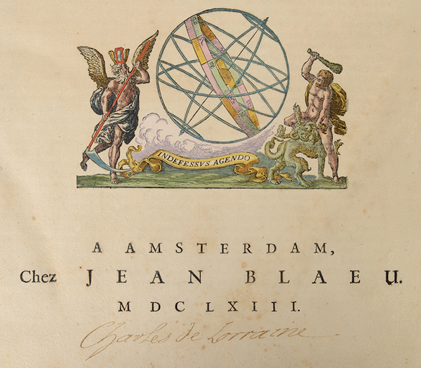
BLAEU, Joan. Le Grand Atlas, ou Cosmographie Blaviaene, en laquelle est exactement descritte la Terre, la Mer, et le Ciel. Amsterdam, J. Blaeu, 1663 [-1662] 10 (of 12) + 1 vols, in all 11 vols folio: 1 allegorical frontispiece, 7 engr. title pages, 533 engr. maps, plans, views and plates, mostly double-paged and all mounted on lvs, finely hand-coloured with details heightened in gold (repairs in vols I, VIII, minor browning, staining and foxing, some margins cropped, some maps wrinkled, some tears, a few wormholes).
Dutch bindings: white ivory vellum over pasteboards with double ornamental gilt frame and gilt centerpiece, handwritten title on ornamented flat spine, gilt edges, remains of green silk ties (traces of glued paper on the inside of vols V-VI, VIII; traces of red wax on the inside of the covers of vols II, VII, X-XII; slightly damaged and loose spines on vols I-II, VI; some stains partic. at the bottom of vol. I).
Extraordinary copy of the first French edition of Blaeu's "Atlas Maior", described as the "greatest and finest atlas ever published" (cf. H. de la Fontaine Verwey). Our set consists of 10 (out of 12) volumes with French text published in 1663 (vol. IV on the Low Countries missing) plus the Latin variant of vol. IX on Italy, dated 1662 and originally being part of the first edition of the "Atlas Maior". Compared to the Latin edition of 1662, our French one is considerably enlarged, making the volume on France too thick for one binding and, therefore, was split into two making a total of 12 vols.
Extraordinary copy of the first French edition of Blaeu's "Atlas Maior", described as the "greatest and finest atlas ever published" (cf. H. de la Fontaine Verwey). Our set consists of 10 (out of 12) volumes with French text published in 1663 (vol. IV on the Low Countries missing) plus the Latin variant of vol. IX on Italy, dated 1662 and originally being part of the first edition of the "Atlas Maior". Compared to the Latin edition of 1662, our French one is considerably enlarged, making the volume on France too thick for one binding and, therefore, was split into two making a total of 12 vols.
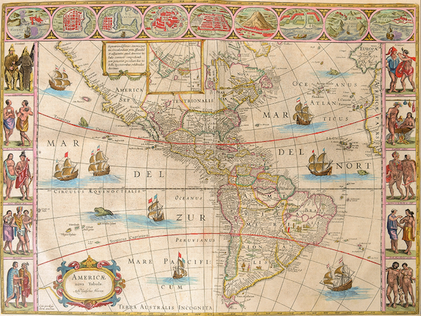
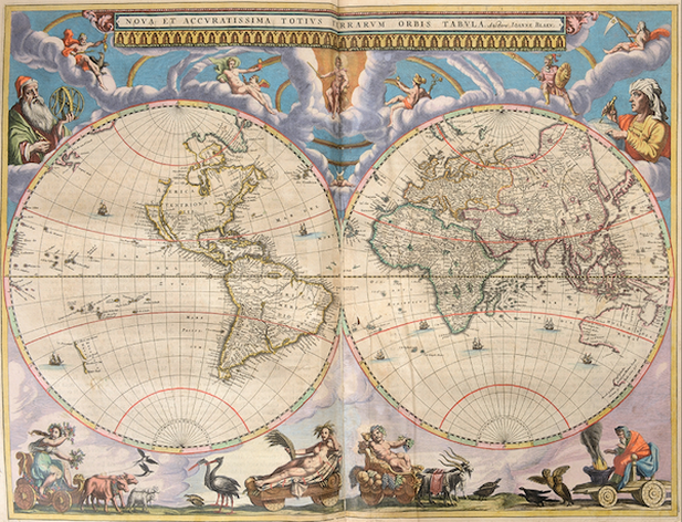
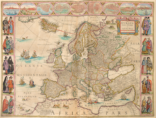
Only 30 copies of this French edition are known. Volume I. Arctic, Norway and Denmark. With its rare engr. frontispiece "Geographia Blaviana" (cropped and underlaid) and 61 maps incl. the magnificent world map in two hemispheres. Volume II. Sweden, Russia, Poland, southeastern Europe, and Greece. 39 maps. Volume III. Germany. 96 maps. Volume V. England. Engr. title page and 58 maps. Volume VI. Scotland and Ireland. Engr. title page and 55 maps. Volume VII. France (part 1). Engr. title page and 36 maps. Volume VIII. France (part 2) and Switzerland. 36 maps. Volume IX (Latin vol. VIII). Italy. Engr. title page and 60 maps, identical to the French vol. it substitutes. Volume X. Spain and Africa. Engr. title page and 41 maps. Without the rare engr. frontispiece on Africa. Volume XI. Asia. 2 engr. title pages and 28 maps. Volume XII. America. 23 maps. Ref. van der Krogt II [2: 611].
Prov. From the library of the Brussels' palace of Charles Alexander of Lorraine with ownership mark in gold pen by his own hand. According to the "Catalogue des livres de la bibliothèque [...] commencé en 1753", our copy is one of the highlights of the "Grande Bibliothèque" of Charles Alexander of Lorraine (1712-1780), governor of the Austrian Netherlands. After his death, Corneille-François de Nélis established a new catalogue from August 1780 onwards. Subsequently Emperor Joseph II, his "neveu par alliance" and legal heir, ordered the public sale of the collections. Hence, our "Grand Atlas" is listed as nr 1639 in the auction catalogue by Joseph Ermens ("...12 vol. in fol. rel.[iés] avec des Cartes & Estampes très proprement enlum.[inées]") and sold for "26 florins argent de change".
Charles Alexander's ownership mark is present on 9 title pages (not in vols I and IX). Ultimately this copy moved to the collection of de Ligne Ref. AGR, SEG 2610 and 2621. - AGR, CF 7639. - Catalogue des livres, estampes, et planches gravées, de la bibliothèque de feue S.A.R. le duc Charles-Alexandre de Lorraine [...]. Brussels, Joseph Ermens, 1781, Nr. 1639.
If you enjoyed this post, please take a moment to leave a comment below...
Thanks to Arenberg Auctions
0 Comments

