- Published on
If you're new to collecting antique maps size does matter! Well you may take the view that your budget is the real deciding factor and that does have merit. However new or novice collectors often lack knowledge on the subject so do well to start small. Yes I do mean literally 'small' not just a smaller budget. There's lots of advantages to collecting small. For one thing you don't have a problem with storage space. You can also mount frame and provide wall space easily with a collection of smaller maps, before you decide to go big.
IMPORTANT: Also it's less of a shock for your partner when they return home from shopping only to discover that large artwork now taking pride of place on your office wall or even the lounge wall! They then ask "How much did you pay for that thing?"
So starting small on most fronts gives you time to find your feet, get a feel for the market and get some experience under your belt, all without spending big! Here's an example of one kind of miniature map. Notice this map carry's big names in the map collectors world even though this is a small map!
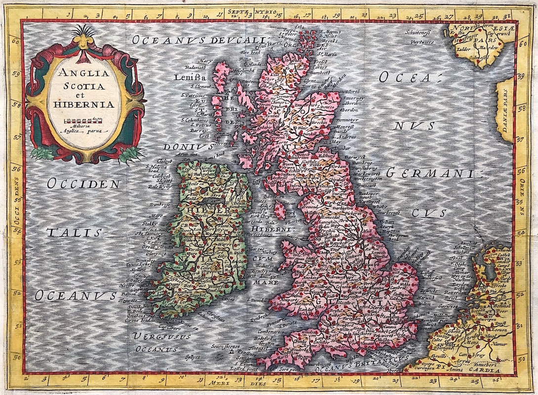
Mapmaker: Mercator, G. / Hondius, J. (Cloppenburgh) from " Atlas Minor Gerardi Mercatoris...Ioannis Cloppenburgij, 1630" The fourth and final series of reduced versions of Mercator's atlas was published by the Amsterdam bookseller Johan Cloppenburgh in 1630. Maps engraved by Pieter Van Den Keere. The maps include decorative cartouches, latitudinal and longitudinal lines, coats of arms, compass rose and show political boundaries, cities, towns, topography, vegetation, waterways and landmarks.
This is an excellent map of the British Isles and Ireland showing the major cities. Large strap work title cartouche. Blank to Verso (Ref: R W Shirley Early Printed Maps of The British Isles 1477-1650 Revised Edition p 123) Approx engraved area 5.5" X 8" (140mm x 200mm).
There are plenty of maps like this example and others to choose from that fall into the miniature or pocket size category. Maps of the world, country and county maps, town plans, road maps, rivers, planispheres, hemispheres, celestial charts, even geographical playing cards with maps on them, to name a few. As a new collector why not investigate what's available and of interest to you in miniature maps Starting small is never a bad thing. . . .enjoy the hunt.
You can find out more about this map HERE
0 Comments

