- Published on
Since last November I've been sharing with you some of the exceptional aquatint prints from Jenkins The Martial Achievements of Great Britain and Her Allies from 1799 to 1815 and Jenkins The Naval Achievements of Great Britain, From the Year 1793 to 1817. Interest in armed conflict with stories of campaigns and battles and the continuing assessment of leaders, tactics and their strategy remains ever popular with military history enthusiasts, historical reenactment groups and antique print collectors.
Closely inked to this interest is a passion for collecting associated military battle plans and maps. Most of these provide military signs and illustrations of fortifications while also providing a knowledge of topographical peculiarities of a country or area to enable a proper understanding of military history. These special 'battle plan' maps are indispensable as such information is simply not available within general geography.
Closely inked to this interest is a passion for collecting associated military battle plans and maps. Most of these provide military signs and illustrations of fortifications while also providing a knowledge of topographical peculiarities of a country or area to enable a proper understanding of military history. These special 'battle plan' maps are indispensable as such information is simply not available within general geography.
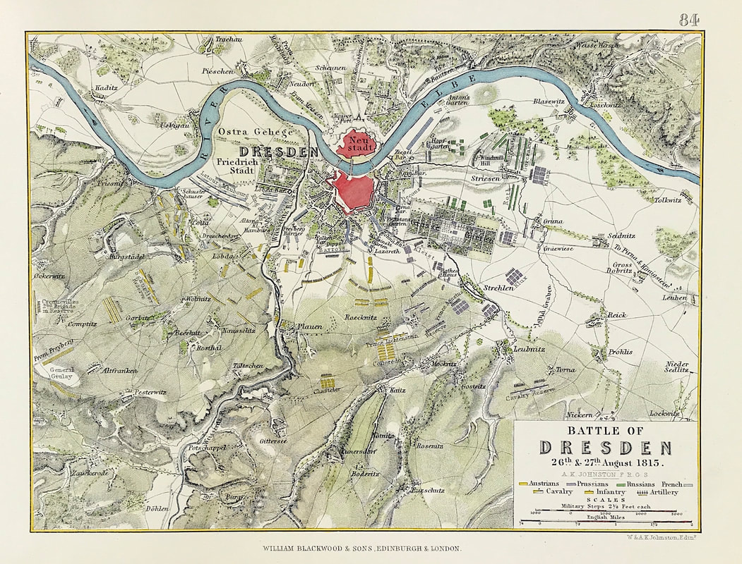
Above: The Battle of Dresden 26th & 27th August 1813, from the Atlas to Alison's History of Europe By Sir Archibald Alison by Alexander Keith Johnson, F.R.S.E F.R.G.S. F.G.S. Published by William Blackwood & Sons, Edinburgh and London c1875. Original map produced with mechanical outline colour. Addition later fine wash hand colour embellishments make this a unique edition of the map.
The Battle of Dresden (26–27 August 1813) was a major engagement of the Napoleonic Wars. The battle took place around the city of Dresden in modern-day Germany. With the recent addition of Austria, the Sixth Coalition felt emboldened in their quest to expel the French from Central Europe. Despite being heavily outnumbered, French forces under Napoleon scored a victory against the Army of Bohemia led by Field Marshal Karl von Schwarzenberg. However, Napoleon's victory did not lead to the collapse of the coalition, and the weather and the uncommitted Russian reserves who formed an effective rear-guard precluded a major pursuit. Three days after the battle, the Allies surrounded and destroyed a French corps advancing into their line of withdrawal at the Battle of Kulm.
These maps and plans provide great incite into such military operations and are a valuable source of information to the ever growing number of passionate military collectors.
You can see more military battle plans HERE.
Happy Hunting!
0 Comments