- Published on
Yesterday one of the world’s greatest libraries of seafaring books and atlases went to auction at Christies in London. This included 203 lots with beautiful 17th century atlases from the Dutch Golden Age of Cartography, important and decorative single-sheet maps, as well rare narratives of the great voyages of exploration and discovery.
For breadth, scope and quality, the Mopelia Collection is one of the finest such collections to appear at auction. Here are some highlights from the sale with hammer sale prices. You can feast you eyes over some of these beauties including Johannes van Keulen's De Groote Nieuwe Vermeerder-de Zee-Atlas ofte WaterWerelt. Published in Amsterdam in 1688, this is a handsomely engraved and beautifully hand-coloured example with the frontispiece and maps highlighted in gold, perhaps one of the greatest 17th-century Dutch sea-atlases to come to the market in recent years.
For breadth, scope and quality, the Mopelia Collection is one of the finest such collections to appear at auction. Here are some highlights from the sale with hammer sale prices. You can feast you eyes over some of these beauties including Johannes van Keulen's De Groote Nieuwe Vermeerder-de Zee-Atlas ofte WaterWerelt. Published in Amsterdam in 1688, this is a handsomely engraved and beautifully hand-coloured example with the frontispiece and maps highlighted in gold, perhaps one of the greatest 17th-century Dutch sea-atlases to come to the market in recent years.
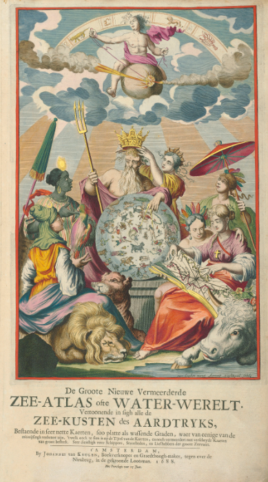
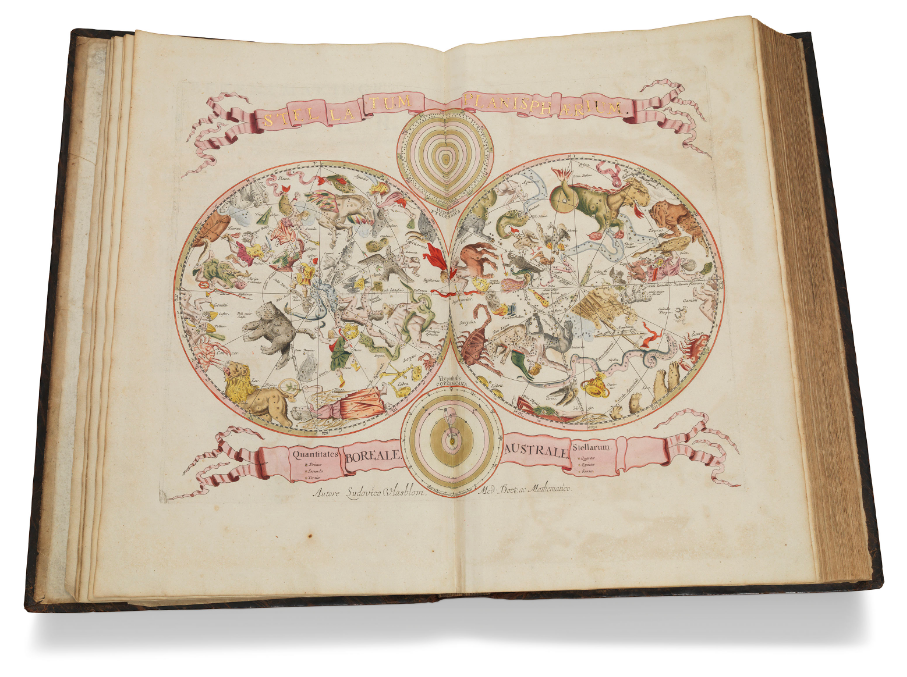
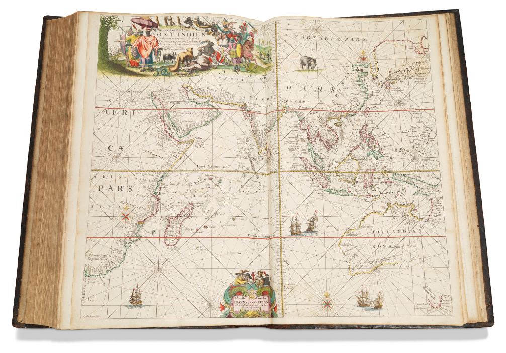
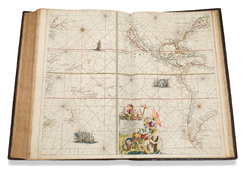
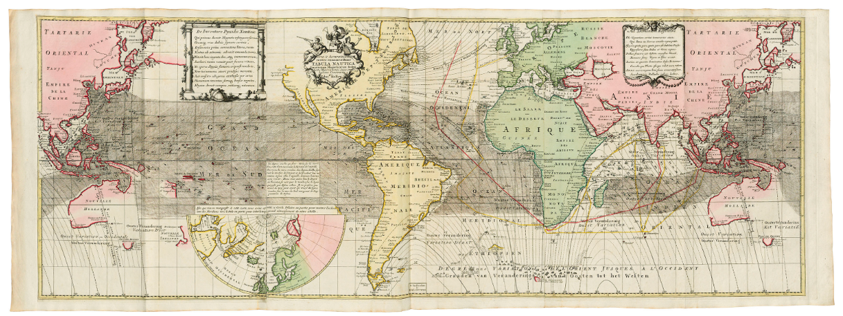
KEULEN, Johannes van (1654-1715). De Groote Nieuwe Vermeerderde Zee-Atlas ofte Water-Werelt. Amsterdam: Johannes van Keulen, 1688. A hand-coloured maritime atlas of unprecedented scope and splendour. The charts after Claes Janszoon Voght combine baroque artistry with a technical ability that resulted in a half century of steady publication for the atlas from 1680 to 1734. Voght also wrote the short text. As Koeman stresses, the atlas was different to its predecessors in going through a process of continual enlargement and in having a content that was so variable. Estimate: £150,000 - £200,000 Sold: £395,250
RENARD, Louis (fl. c.1702-1707) – Reinier OTTENS (1698-1750) and Josua OTTENS (1704-1765). Atlas van Zeevaert en Koophandel door de Geheele Weereldt. Amsterdam: Reinier and Josua Ottens, 1745. Magnificent, hand-coloured copy of the corrected issue of Renard’s Atlas de la navigation et du commerce (Amsterdam: 1715), which had been printed from plates used for Frederik de Wit’s maritime atlas of c.1675. The firm of R. and J. Ottens produced a French edition in 1739, slightly different from 1715, and then this 1745 edition with Dutch text and careful correction of the plates. Estimated: £25,000 - £35,000 Sold: £50,000
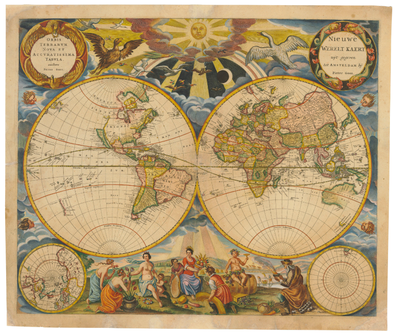
GOOS, Pieter (1615/1616-1675). Orbis Terrarum Nova et accuratissima tabula. Nieuwe Werelt Kaert. [Amsterdam: 1666 or later]. Very rare double-hemisphere world map, from Pieter Goos' maritime atlas, 'the finest printed at the time' (Shirley). This map's predecessors were the world maps published by Visscher and Blaeu - in fact Goos' atlases were often added to Blaeu's Atlas Maior as a maritime supplement. Estimate £6000 - £8000 Sold: £11,250
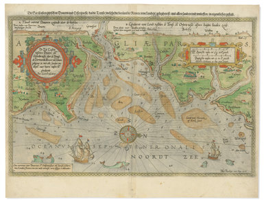
WAGHENAER, Lucas Janszoon (1533-1606). De Zee Custen tußchen Dovere en Orfordtsneße, daer de Teemse de Vermaerde Rivire va Lonen gelegen is. [Amsterdam: Cornelis Claesz, 1588]. Van Doetecum engraved map of the coast of eastern England, from Dover to Great Yarmouth, showing the mouth of the Thames, coloured by a contemporary hand. Koeman IV, Wag 6 (23c); New Hollstein 816/VII. Estimate £800 - £1200 Sold: £1500
For those of you who like to know the numbers: Sale total including buyer’s premium: GBP 2,301,000
Source and with thanks to Christies.com
0 Comments

