RARE MAPS AND PRINTS
help@raremapsandprints.co.uk
+44 7788 628706
  • Start Here
  • About
  • Maps
    • British Isles
    • English Counties
    • Road Maps
    • River Thames
    • The Americas
    • Asia to Australia
    • Europe & Middle East
    • World & Hemispheres
    • Sea Charts
    • Military Battle Maps
  • Prints
    • British Topography >
      • Views River Thames
      • Views England
      • Views Wales
      • Views London
    • Satire & Caricature >
      • Vanity Fair Prints
      • Tour of Dr Syntax
      • William Hogarth
      • Max Beerbohm
    • Sporting
    • Amorial
    • Military & Naval
    • Portrait
    • Russian Art
    • Views Italy
  • Engravings
    • Copper
    • Steel
    • Etching
    • Wood Block
    • Lithograph
    • Lithotint
    • Aquatint
    • Photogravure
  • Resources
    • Reference Books
  • Blog
  • The Colourist
  • Contact

Collecting Antique Maps - How do you see the world?  More Tips for the Novice

9/26/2020

Comments

 
For those new to collecting antique maps the passion sometimes starts with just wanting to put something on the wall. Now you're thinking maybe a map would look the part.  Before you even get into anything serious and asking questions like what should I collect? or even how do you get started with collecting?   At this stage its more, what will look good on the wall?

If that's you then maybe consider a map of the world or some kind of map projection. This is a good place to start.  Hemisphere projections are those maps you see that convert half of a spherical world to a circle.  These hemispheres kind of change how we see the world. They are normally centered on the Western-Eastern or Northern-Southern  hemispheres.  The larger hemispheres also look pretty impressive with a well selected mount and frame.  This could be you're first choice in starting with a map thats really a piece of wall art for your home.   Also it's bound to be a conversation starter when you have you're friends around for dinner!
Picture
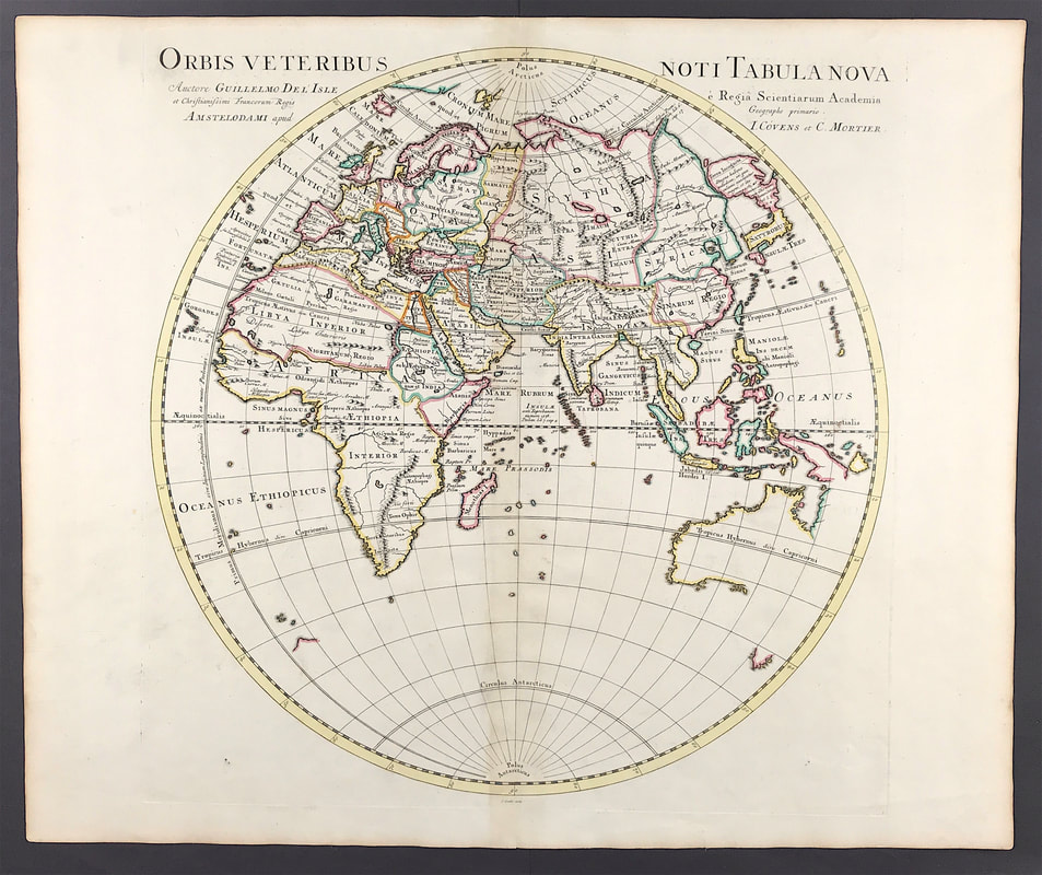
Above: Original Antique Map c1730 "Eastern Hemisphere" Orbis veteribus noti tabula nova by Guillaume De L'Isle (1675-1726) Published: Amsterdam, J Covens & C. Mortier. Approx engraved area: 19.5" X 19.5".

This early eighteenth century French cartographer was renowned for the accuracy of his maps. Australia is shown according to the two voyages of Abel Tasman 1642-1644.  De L'Isle studied under Jean Cassini and from an early age showed his talent. De L'Isle is important as the first "scientific" cartographer who incorporated the most current information on exploration and topography into his maps. Where he was unable to verify information conclusively, he would note the fact on his maps.

You can see the full details for "Orbis veteribus noti tabula nova"  HERE
Comments

    LEARN ABOUT MAPS

    Where to Start?  
    The Paper  
    Earliest Maps  
    Whats on the Paper? 
    Rectum & Recto  
    Marketing Devices   
    Why Changing Faces?
    What is  Ornamentation?
    Why all those lines?
    The Embellishment Story

    Illogical Prices Explained
    ​A Reference Library
    ​
    CLICK THE BOOK
    Picture
    Get the FREE Guide!
    ​
    ​
    COLLECTING MAPS

    ​Size Matters!

    Celestial Maps
    Strip Road Maps
    Sea Charts
    On the River of Life
    Projections
    The Sea Monsters
    Thematic Maps
    ​Town Plans


    Buy with Confidence. . . 
    Picture
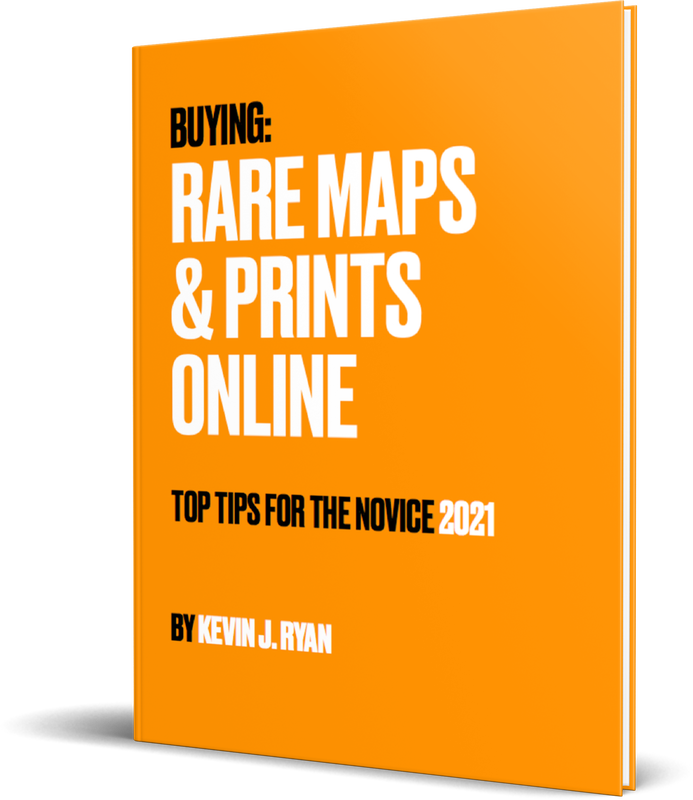
    More Top Tips for the Novice.  Click the book to find out more . . .
    COLLECTING PRINTS
    ​

    Views of River Thames
    Views of London
    Shipping & Craft
    ​Meet the Fairies
    Maritime Naval
    Military Battles
    Botanical 
    Historic Churches
    Historic Views of Rome

    Archives

    July 2021
    June 2021
    May 2021
    April 2021
    March 2021
    February 2021
    January 2021
    December 2020
    November 2020
    October 2020
    September 2020
    March 2020
    November 2019
    June 2019
    May 2019
    April 2019
    March 2019

Contact Info:     
Rare Maps and Prints Limited 
4, Ray House, Cressington Place,
​Bourne End, Bucks SL8 5SL UK 
                             
Kevin J Ryan :     

email: kevin@raremapsandprints.co.uk         
​
Customer Service     
email: help@raremapsandprints.co.uk           
Picture
Member of
​INTERNATIONAL MAP COLLECTORS SOCIETY 


    Maps & Prints Updates

Subscribe to List

Copyright © 2021  -  Rare Maps and Prints Limited  -  Raremapsandprints.co.uk   All Rights Reserved     Site Map     Terms & Conditions     Privacy Policy
  • Start Here
  • About
  • Maps
    • British Isles
    • English Counties
    • Road Maps
    • River Thames
    • The Americas
    • Asia to Australia
    • Europe & Middle East
    • World & Hemispheres
    • Sea Charts
    • Military Battle Maps
  • Prints
    • British Topography >
      • Views River Thames
      • Views England
      • Views Wales
      • Views London
    • Satire & Caricature >
      • Vanity Fair Prints
      • Tour of Dr Syntax
      • William Hogarth
      • Max Beerbohm
    • Sporting
    • Amorial
    • Military & Naval
    • Portrait
    • Russian Art
    • Views Italy
  • Engravings
    • Copper
    • Steel
    • Etching
    • Wood Block
    • Lithograph
    • Lithotint
    • Aquatint
    • Photogravure
  • Resources
    • Reference Books
  • Blog
  • The Colourist
  • Contact

    Join Our List

sign up
SHOP
Home
Shop
About
Updates
Contact
SOCIAL
Facebook
Twitter
Instagram
Proudly powered by Weebly